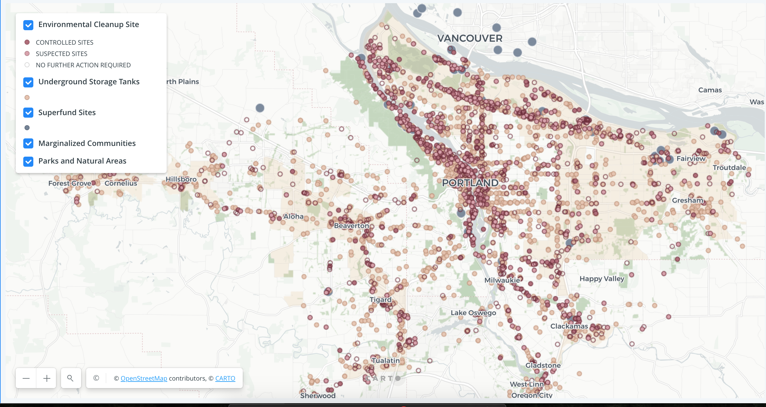
Brownfields in the Portland Metro
As part of my internship with Metro I am part of the Regional Snapshot team, which produces articles, infographics and maps on the changing Portland region. As part of the 2017 jobs Snapshot, I produced an interactive map of brownfields in the region so that viewers can understand contaminated sites in their neighborhoods.
I collected data from the Department of Environmental Quality and the Environmental Protection Agency, weeded out the the unnecessary information, and assembled it beautifully in Carto.
A link to the map can be found here.
A link to the article including the map can be found here.
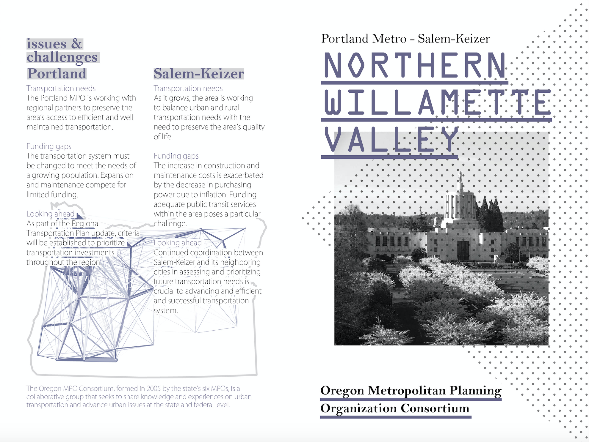
Oregon Metropolitan Planning Organization Consortium
These maps are part of a series of brochures to be distributed at Oregon Metropolitan Planning Organization Consortiums. They were designed in 2017 while interning at Oregon Metro. The layout and graphics were produced by Yana Stannik and I produced the maps.
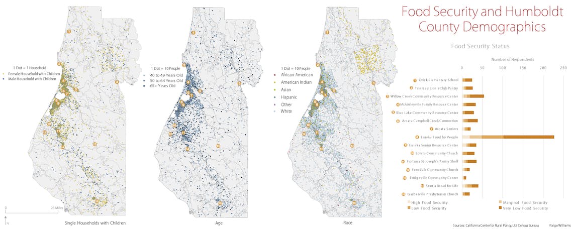
Food Security in Humboldt County
This map was created for the California Center for Rural Policy (CCRP) to visualize the population demographics that the local food pantries serves. Using data from the US Census Bureau and survey results collected by the CCRP, the viewer can see who are living with different levels of food security.